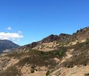
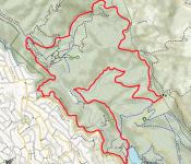
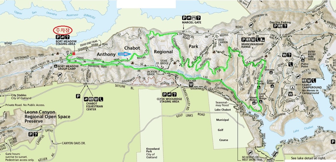
11월10일(토)Anthony Chabot Regional Park
Shortcut
PrevPrev Article
NextNext Article
Shortcut
PrevPrev Article
NextNext Article
| 산행지 | Anthony Chabot Regional Park |
|---|---|
| 난이도 | Moderate (중간) |
| 예상거리 (mi) | 10 miles |
| 고도변화 (ft) | 700 |
| 예상 산행시간 (hr) | 5 시간 |
| 모이는 시간 및 장소 | Anthony Chabot Regional Park 9AM |
| 산행 준비물 | 각자 본인의 점심 및 간식, 충분한 양의 물 |
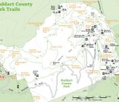
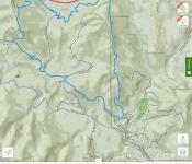
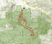
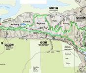
찾아오시는길
https://goo.gl/maps/JQexbY1tYh32
@: 2차 집결지
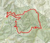
Trail Map:
Horseshoe (0.08) -- Grass Valley (0.96) -- Redtail (1.29) -- Cottontail (0.55) -- Brandon (0.49) -- Escondido (1.39) --
Brandon (0.59+0.2+0.2) --Two Rocks (0.62) -- Columbine (0.5+0.46) -- Cascade (1.03) -- Brandon (0.66+0.5) --
Horseshoe (0.36+0.08) = 9.96 (10 마일)
 11월10일(토) Little Basin SP (Boulder Creek, CA)
 11/3(토) Pleasanton Regional Park 정기 산행
-
?
참가합니다
-
?
나도 가야지~~ ㅎ
-
?
참석합니다
-
?
송암,소연 참가합니다
-
?
안녕하세요
청강ㆍ반달 참가합니다 -
?
드디어 뵙게되네요 청강님 반달님 반갑습니다
-
 봉우리 참석합니다.
 -
 참가합니다.
날씨가 도와주면 Harley 타고 가겠습니다. -
?
참가합니다
-

갑니다사정이 생겨 불참합니다. 즐산하세요. -
?
참가합니다
-
 첫 산행 축하 드립니다.
 -
 참가합니다.
 -
?
대박&지니베이비 참가합니다
-
?
다들 내일 뵙겠습니다.
새식구들 만날 생각을 하니 마음이 설렙니다 ㅎ -
 늦었읍니다만 참가합니다
-
(취소) 12/15/18 (토) Mount St. Helena - Napa County 5

-
12/08(토) 송년산행 Huddart County Park 49
-
토요산행, 12/01/2018, Tarwater Creek 40
-
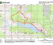
11/23 (금) Echo Peak, Lake Tahoe 10
-
11월24일<토> Mt. Diablo (Eagle Peak to Mt. Diablo) 13
-
11/17(토) Mt. Madonna County Park 23
-
11월10일(토) Little Basin SP (Boulder Creek, CA) 15
-
11월10일(토)Anthony Chabot Regional Park 16
-
11/3(토) Pleasanton Regional Park 정기 산행 25
-
10월27일 토요일 Lake Tahoe 5
-
10/27/18 (토) Big Sur - Post Summit 5
-
10/20/2018(토) Tilden Park 13
-
10/13/2018 이벤트 산행 (Redwood RP) 56
-
Echo Peack 취소 ---- 죄송합니다. 개인적인 일이 생겨서 취소합니다. 7
-
[정기] 10/6(토) Las Trampas Regional Wilderness (Ringtail Cat Madrone Loop Trail) 22