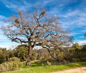
10/21/2017 (토요일) Castle Dome - 산행취소
Shortcut
PrevPrev Article
NextNext Article
Shortcut
PrevPrev Article
NextNext Article
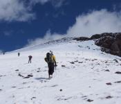
| 산행지 | Castella |
|---|---|
| 난이도 | Moderate (중간) |
| 예상거리 (mi) | 8mi |
| 고도변화 (ft) | 3.106ft |
| 예상 산행시간 (hr) | 6-8hr |
| 모이는 시간 및 장소 | 트레일헤드 입구 9:30am |
| 산행 준비물 | 각자 본인의 점심 및 간식, 충분한 양의 물 마지막 Dome구간에( 난이도 클라스4) 확보가 필요하신분은 하네스 와 잠금카리비너1개 가져오세요 |
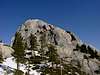
Part 1 (Class 2-3) The first portion of the climb just climbs up a 30° ramp with two switchbacks as seen in this photo. The topmost diagonal follows a prominent quartzite vein in the rock.
Part 2 (Class 2+) Once you get to the top traverse around the east side and you will come to "the dish" a 10 foot wide tilted, shallow bowl in the rock. Crossing the dish normally isn't an issue because the rock is solid here with good grip, however, if you did happen to fall about 10 feet down, you'll find yourself falling over a ledge and there's a long way to go before you hit bottom. A belay here is nice for some people. There's a tree about 5 feet away from the far end of the dish that you can use as an anchor.
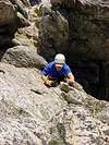
Part 3 (Class 3-) Once you get across the dish, you will see the gully to your left. Climb the gully which will end at a small flat area between the rocks.
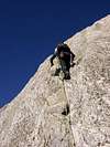
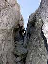
Part 4 (Class 4-): You have two choices now. You can either climb "the stairs" or a gently sloping rock face with numerous holds (similar to chickenheads). There's one or two ledges before you get to the summit. There's more air on "the stairs" variation which is fun to use on the ascent, however, less experienced climbers will feel more comfortable taking the rock slabs down to the top of the gully. Here are photos looking up the stairs and looking down the stairs. At the top of "the stairs" there's another small tree where you can anchor in.
This should get you to the top but I should probably go back and do this another time to verify ;-)
 |  |  |  |
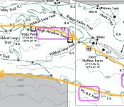
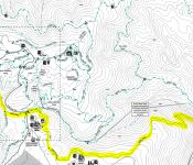
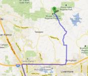
찿아오는 길 : https://goo.gl/maps/3p7hYPhTy442
-
?
썰 ~~렁 하네요. 손님이 없어서 산행 취소합니다.
-
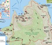
(8/22, 토)Angel Island State Park 22

-
08/08/2015 (sat) Pescadero Creek Country Park 21
-
7/25/15 (토) Purisima Creek Redwoods OSP 27
-
7/11) (토) Anthony Chabot Regional Park 19
-
6/27/15 (Sat) Big Basin Redwoods State Park 14
-
6/20/15 (토) Windy Hill Open Space Preserve 20
-
6/20/15 (토) Rancho San Antonio OSP {{퍼밋관계로 취소합니다}} 7
-
6/13/2015 (Sat) Alum Rock Regional Park 24
-
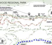
5월 31일 (일) Redwood Regional Park - East Bay Area 10
-
5/29-30 (금/토) Mt. Langley 번개 14
-
2015/5/23 (토) Sanborn County Park 27
-
05/09/15(토) Point Bonita 11
-
5/8(금) - 5/10(일): 2박3일 캠핑 : GROVER HOT SPRINGS SP, CA 40
-
4/25/15 (토) Marin Headlands - Point Bonita 37
-
4/25/15 (토) Henry Coe Backcountry 2015 Event 52
-
4/11(토) Mt Diablo 14
-
캔슬 되었습니다. 4/11 토: MT Madonna County Park 7
-
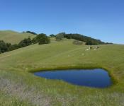
3/28 (토) Morgan Territory 40
-
3/14/15 Pescadero Creek CP 11
-
3월14일15년토요일 Red lake peak 눈산행. 31