부정기
2017.06.21 10:59
6/24/17 (토) Gap/Ridge Large Loop
Views 31838 Comment 2
?
Larger Font
Smaller Font
Up
Down
Update Log Go comment
Print Attachment Shortcut
PrevPrev Article
NextNext Article
?
Larger Font
Smaller Font
Up
Down
Update Log Go comment
Print Attachment Shortcut
PrevPrev Article
NextNext Article
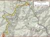
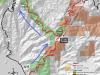
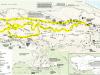
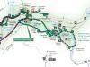
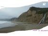
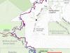
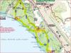
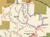
| 산행지 | 6/24(토) Gap/Ridge Large Loop (13.0 mi, ~2300 feet elevation gain) |
|---|---|
| 난이도 | Moderate (중간) |
| 예상거리 (mi) | 13 |
| 고도변화 (ft) | ~2300 |
| 예상 산행시간 (hr) | 6 |
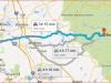
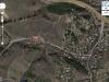
| 모이는 시간 및 장소 | Saratoga Gap 주차장 ( 37.258327, -122.121298 ) @8:30 AM |
| 산행 준비물 | 각자 본인의 점심 및 간식, 충분한 양의 물 |
다음주 원거리 산행이 있어 이번주는 근교산행을 하려고 합니다. 기회가 되면 한번 하려고 꼬불쳐둔 산행지 입니다.
아마 산악회에서도 같은 코스로 간적은 없지 싶습니다. 저도 구간별로 안가본데도 있구여.
여기 파킹랏이 MTB 바이커나 하이커들로 일찍 찰수 있습니다. 해서 산행시작 시간을 8시30분 으로 정했습니다.
참가 하실분이 안계심 더 일찍 할수도 있구여.
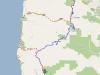
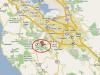
찾아 오는길 : https://goo.gl/maps/9vdhgpJXN9t
Favorite Run #2: Gap/Ridge Large Loop (13.0 mi, ~2300 feet elevation gain)
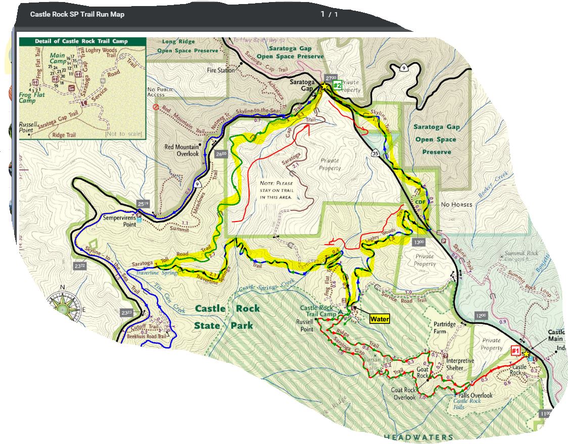
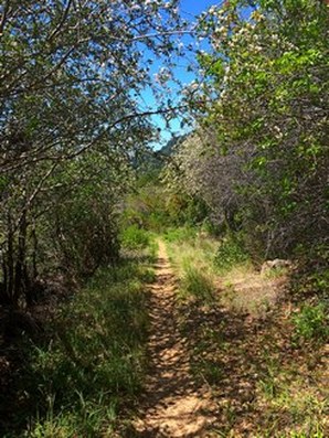
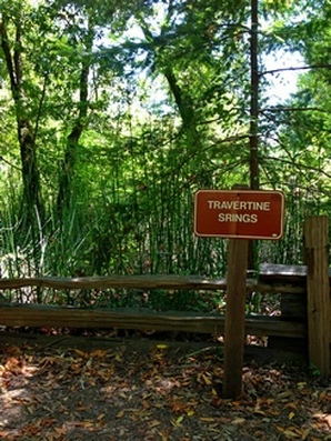
This loop is a challenging but beautiful run with some great climbing and excellent views. It incorporates the highlights of the previous run with a trip to Travertine Springs and a steady, moderate climb up Saratoga Toll Road. For this route we strongly recommend that you bring a trail map or download the GPX track to your GPS device, since some of the turns are confusing. This run starts at the Saratoga Gap parking lot. To start the run, head south on the Skyline trail, which begins at the southeast side of the parking lot (the side of the parking lot opposite from Hwy 9). GPX Track Printable Trail Map Driving Directions Route Details:
https://www.alltrails.com/explore/map/skyline--240 (아마도 링크를 클릭하면 안보이실 겁니다. 아래 맵이...) 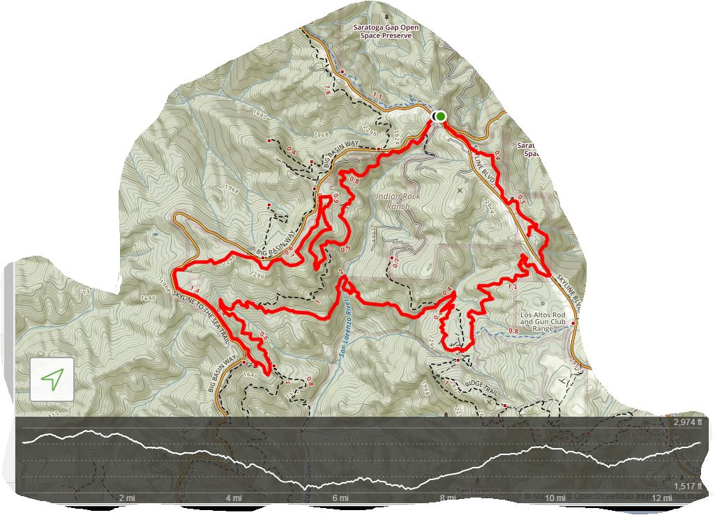 |
- ?
-
?
토욜 아침! 갈까말까 고민하다 동네 평지트레일 3시간으로 땡. 여기는 담 기회에..
-
Read More
11/29 (토) Skyline-to-the Sea
Saratoga Gap에서 Skyline-to-the Sea의 일부를 걸어보고자 합니다. 5-6마일정도 걷다가 다시 돌아오는 길입니다. (총 10-12 마일) 베이 산악회에서는 처음인것 ... -
Read More
Cancelled # 부정기: 11/29/14 (토) Oat Hill Mine Tr...
와인으로 유명한 나파발리의 북쪽 Calistoga 에 위치한 스티븐슨 주립공원에 있는 OAT HILL MINE Trail 과 Palisades Trail 에 감니다. Oat Hill Mine Trail 을 ... -
Read More
Nov 22 (토) - Redwood Regional Park, East Bay Area
* 부정기입니다. 비가 덜 올만한 곳을 찾아서 올려 주셔도 환영합니다. * 아래 링크를 누르면 날씨를 볼 수 있습니다. 비가 예상 되지만 그래도 갑니다. http://w... -
Read More
11/8: Clouds Rest
올해가 가기전에 Clouds Rest를 다녀오고 싶어 올려봅니다. 당일 산행입니다. - 현재로는 날씨가 좋게나오는데, 기상이 악화되면 취소하겠습니다. - 찾아오는길 ... -
Read More
11/08/2014: Butano State Park - Trail Camp
알타픽을 올리려고 했는 데 일이 있어 가까운 곳을 올립니다. 트레일은 바뀔수 있습니다. -
Read More
11/8/14 (산악자전거) 2nd Mountain Bike Ride
Due to rain, the 2nd beginning mountain bike ride/class on 10/25/14 was cancelled. We will be holding the rescheduled ride on Saturday, 11/8/14. The me... -
Read More
10/25/14 Castle Rock State Park
져는 Half Dome 가느라 같이 참석 못해 죄송합니다. 벽송님이 안내하십니다. 서로 협력하셔서 안산, 즐산 하시기 바랍니다. 날씨는 요기를 보세요. -
Read More
10월 24-25(금-토) 제4차 요세미티 하프돔
매해 봄과 가을로 진행하는 [요세미티 하프돔] 산행이 4회를 마지했습니다. http://www.bayalpineclub.net/362079 에 올라왔던 글을 참조해 주시기 바랍니다. LYV... -
Read MoreNo Image
10/25/14 (산악자전거) 2nd Beginning Mountain Bike Ride
We will be holding 2nd beginning mountain bike ride/class. We will be riding at different location this time around. We will meet at Grizzly Flat Trail... -
Read More
10/18/14 Coastal Trail to Wildcat Camp, Pt. Reyes NS
이번 토요일엔 쉬운것과 중간 난이도의 선택이 있습니다. 가벼운 산행을 원하시면 아리송님이 올리신 Point Lobos 로 선택하시고 좀 더 장거리 산행을 원하시면 P... -
Read More
10/11/2014 San Pedro Valley County Park
이 곳은 올 1월에 많은 회원님들이 함께 하신 아름다운 곳입니다. (후기 참고) 유칼립튜스 향을 통과하여 올라 가면 저 멀리 시원한 바다가 보이고요, 거기를 더 ... -
Read More
9월28~30일 일,월,화 (2박3일 백팩킹) Point Reyes 지역
9월말 산/베어님 주최로하는 캠핑을 선약으로 참석못합니다. 그 안타까움과 서러움을 달래고저 올립니다. 아마 홀로 산행이 될것 같지만, 시간이 되시는 회님은 ... -
Read MoreNo Image
9월26~28일 금,토,일(2박3일캠핑) China Flat camp Lak...
금년이 가기전에 회원님들 모두 다함께 어울려 가을 야유회겸 소풍을 가려고 모든 회원님들을 초대합니다. 우리 잠시 시간을 내어서 신구회원님들이 한자리에 모... -
Read MoreNo Image
9월13일(토) Pyramid peak (9983 ft)
오랜만에 땀빼러 감니다 ^^ 같이 가실분은 저의 가게앞에 6:50까지 오시면 산행지까지 안전하게 모셔드립니다. % 이번코스는 class2에 해당하는 돌밭입니다 손가... -
Read More
09/13/2014 (토) 부정기 산행: Pinnacles National Mon...
Pinnacle National Monument 에는 동쪽 입구와 서쪽 입구가 있는데, 길이 서로 연결되어 있지 않습니다.반드시 동쪽 입구로 오셔야 합니다. 굴을 통과하기 위해서... -
Read More

9월20일(토) - Beginning Mountain Biking (산악자전...
Per request from some BAC members, a beginning mountain biking class/ride is being offered on September 20th (Saturday). The meeting place will be at p... -
Read More

8/30/14 (토) SF Lands End
2차 집결지: Cliff House 위쪽에 Lands End Lookout 이라고 Information Center 가 있습니다. 여기서 츠레일 지도 픽업할수있고 화장실 있고요. Coastal Trail 시... -
Read MoreNo Image
8/29(금)--9/1(월) Labor Day 연휴 백패킹
다가오는 Labor Day 연휴 산행으로 본래는 요세미티로 갈 예정이었습니다만 그곳의 연휴 인파등등 사정을 고려하여 산행지를 변경했습니다. 요세미티 바로 북쪽 ... -
Read MoreNo Image
8월 23일(토) Arroyo Seco Gorge Hike
Los Padres National Forest 에 있는 Arroyo Seco 계곡으로 "Gorge Hike"를 합니다. (1) 다음 두 유튜브 비디오를 참고하시면 Arroyo Seco Gorge Hike 에 대한 개... -
Read More
8월 23일 (토) Mt. Diablo Summit
부정기 산행입니다. 베어님께서 인도 하십니다. 오래간만에 빡세게 산행할 계획입니다. 쉬운곳을 원하시는분들은 자유롭게 다른곳을 올려 주시기 부탁드립니다. ...
여기 코스가 다양해서 ~20마일정도의 그늘구간 골라서 산행하기에 참 좋습니다. 산호세 지역분들 한테는 접근성도 용이하고, 그늘도 많고, 파킹Fee도 없고..
삼순이랑 참가 합니다.