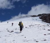
다음주 원거리 산행이 있어 이번주는 근교산행을 하려고 합니다. 기회가 되면 한번 하려고 꼬불쳐둔 산행지 입니다.
아마 산악회에서도 같은 코스로 간적은 없지 싶습니다. 저도 구간별로 안가본데도 있구여.
여기 파킹랏이 MTB 바이커나 하이커들로 일찍 찰수 있습니다. 해서 산행시작 시간을 8시30분 으로 정했습니다.
참가 하실분이 안계심 더 일찍 할수도 있구여.
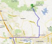
찾아 오는길 : https://goo.gl/maps/9vdhgpJXN9t
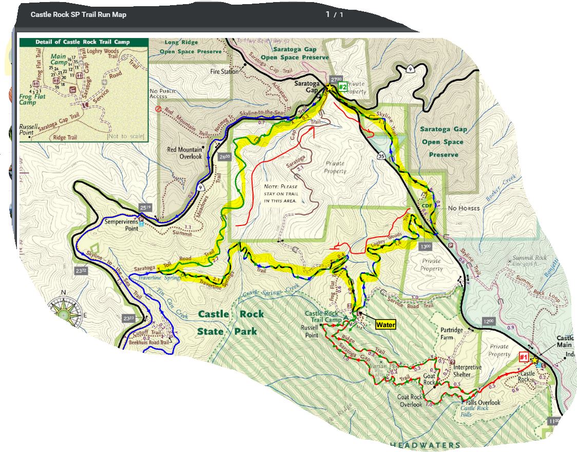
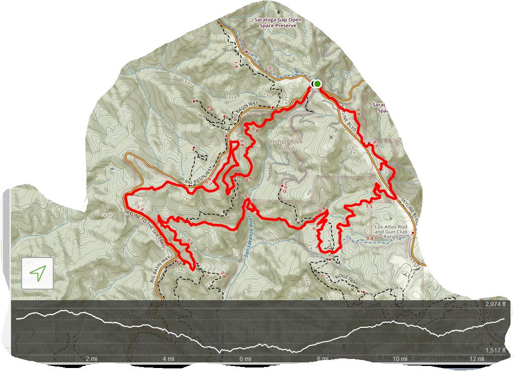
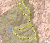
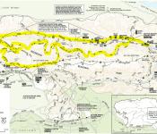
Favorite Run #2: Gap/Ridge Large Loop (13.0 mi, ~2300 feet elevation gain)
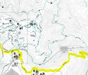
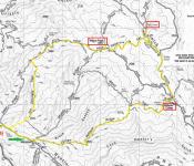
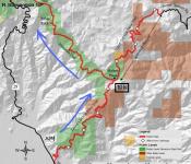
This loop is a challenging but beautiful run with some great climbing and excellent views. It incorporates the highlights of the previous run with a trip to Travertine Springs and a steady, moderate climb up Saratoga Toll Road. For this route we strongly recommend that you bring a trail map or download the GPX track to your GPS device, since some of the turns are confusing. This run starts at the Saratoga Gap parking lot. To start the run, head south on the Skyline trail, which begins at the southeast side of the parking lot (the side of the parking lot opposite from Hwy 9). GPX TrackPrintable Trail MapDriving DirectionsRoute Details: - 0.0 mi: Start out on the Skyline Trail. The trail will climb for a bit and then flatten out.
- 1.1 mi: Stay left on the "Pedestrians Only" trail.
- 1.5 mi: (EASY TO MISS) The Skyline Trail will run near the shoulder of Skyline Blvd and intersect a driveway. At this point, cross over Skyline Blvd and get on the Loghry Woods Trail. (Note: It is very hard to see the Loghry Woods Trail, but you can tell when to cross because this is the first time that the Skyline trail runs along the shoulder of Skyline Blvd.) The Loghry Woods Trail is a fun singletrack descent.
- 3.3 mi: Loghry Woods Trail ends on the Service Road Trail. Turn right toward the campground.
- 3.4 mi: (WATER) At the Castle Rock Trail Camp. Get water if needed, then continue along the Service Road. Veer left slightly to stay on the road, and then turn right onto the first singletrack, which is the Saratoga Gap Trail. After climbing down a rocky section you will pass a few small trails on your left, but stay right to head toward the Ridge Trail.
- 3.5 mi: Veer left to get on the Ridge Trail. You will climb for a mile or so.
- 4.3 mi: Pass the Connector Trail on your right. Stay on the Ridge Trail.
- 4.6 mi: Keep right to continue on the Ridge Trail toward Goat Rock.
- 4.8 mi: At Goat Rock. Say 'hi' to the rock climbers, then continue down the steps on the Ridge Trail.
- 5.3 mi: Intersection with the Saratoga Gap Trail. Cross the stream and make a hard right turn onto the Saratoga Gap Trail.
- 5.4 mi: At the falls overlook. Stop, admire the falls, then continue on Saratoga Gap Trail for two miles. You will pass the Connector Trail on your right, and then get ready for some great views! You will also pass a section where a cable has been installed as a handhold because the trail is narrow and tricky.
- 7.3 mi: Intersection with the Ridge Trail. Stay left to continue back towards the Castle Rock Trail Camp.
- 7.4 mi: (WATER) Back at Castle Rock Trail Camp. Get water if needed, then start heading downhill on the Saratoga Gap Trail towards Saratoga Gap (this is a wide fire road). After crossing a bridge, keep an eye out on your left for Travertine Springs Trail.
- 8.1 mi: Turn left onto Travertine Springs Trail. This trail is a great singletrack that first descends to the San Lorenzo Creek and then climbs back up to Saratoga Toll Road with spectacular views along the way. (Interesting factoid: The tiny San Lorenzo Creek turns into the big San Lorenzo River which flows through Felton and finally empties into the ocean in Santa Cruz.)
- 10.2 mi: Travertine Springs Trail ends. Turn right onto the historic Saratoga Toll Road and start climbing! You will climb for about three miles.
- 12.6 mi: Pass Skyline-to-the-Sea Trail on your left. Continue climbing on the Saratoga Toll Road towards Saratoga Gap.
- 12.9 mi: Saratoga Toll Road Trail ends at Highway 9. Turn right and run along the shoulder to get back to the parking lot.
- 13.0 mi: Back at your car!
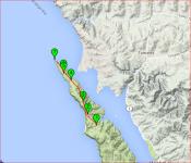
Skyline --> Logrywood --> Castle Rock Trail Camp --> Travertine Springs Trail --> Saratoga Toll Road Trail : (13Mi, 2300ft) | 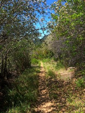 Travertine Springs Trail 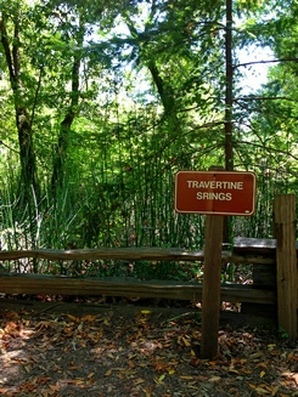 Wait |
https://www.alltrails.com/explore/map/skyline--240 (아마도 링크를 클릭하면 안보이실 겁니다. 아래 맵이...)
| |
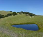

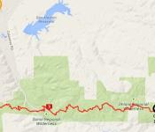
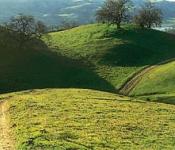
여기 코스가 다양해서 ~20마일정도의 그늘구간 골라서 산행하기에 참 좋습니다. 산호세 지역분들 한테는 접근성도 용이하고, 그늘도 많고, 파킹Fee도 없고..
삼순이랑 참가 합니다.