Edgewood Park and Preserve,
친구랑 가볍게 조깅을 한곳인데 경치가 너무 멋있어 추천합니다. 아주짧은 거리인데, 조용하고 사람도 별로 없지만 동네 산행으론 아주 적합한거 같습니다. 얼마전 발견한곳인데, 산마테오나 레드우드 시티, 포스터 시티에 사시면 동네 산책으로 좋을거 같더군요, 가까와서. 번개 호응도 0% 라 번개는 더 이상 못치지만, 이곳은 다른 분께 추천 합니다 Edgewood Park and Preserve, County of San Mateo, San Mateo County | |||
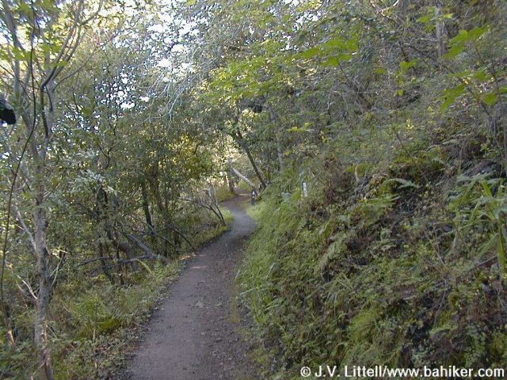
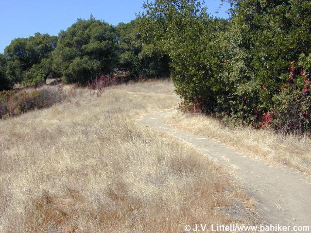
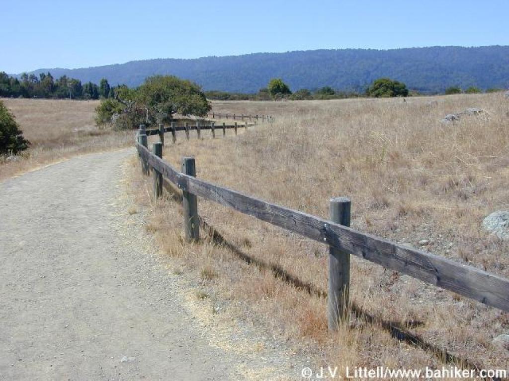
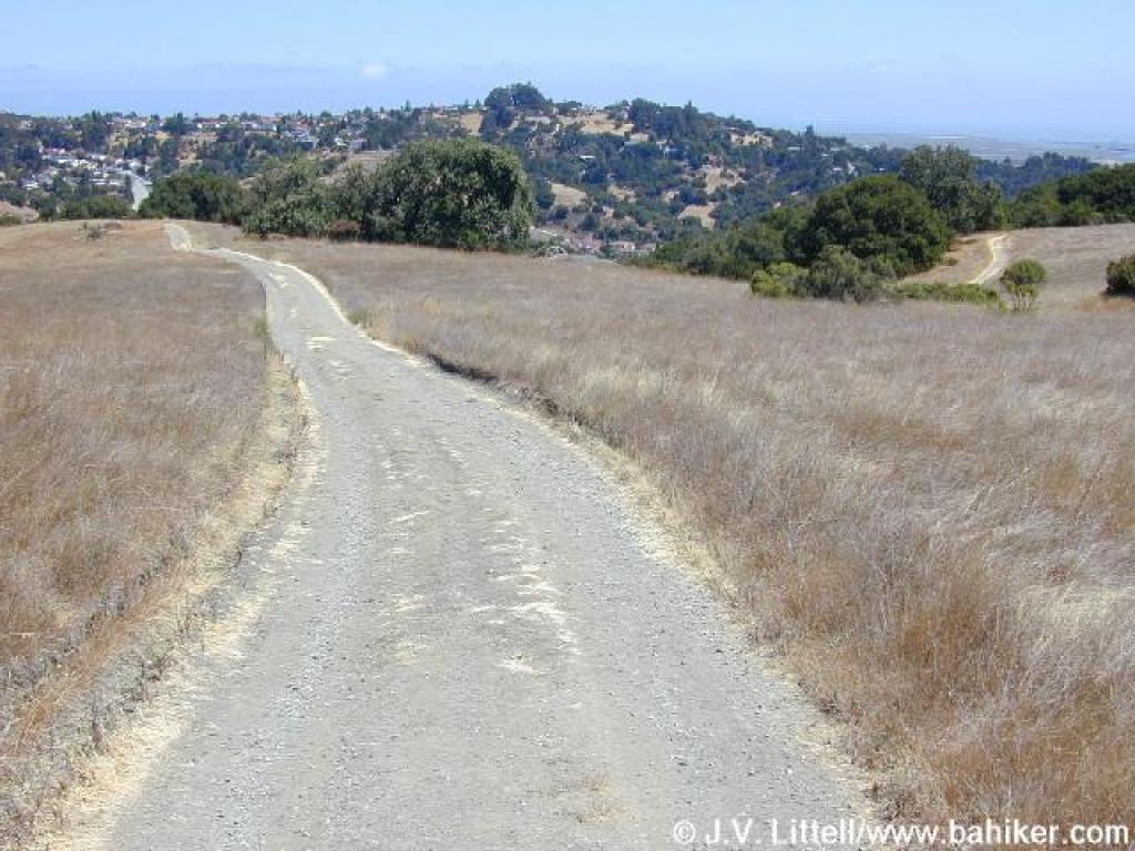
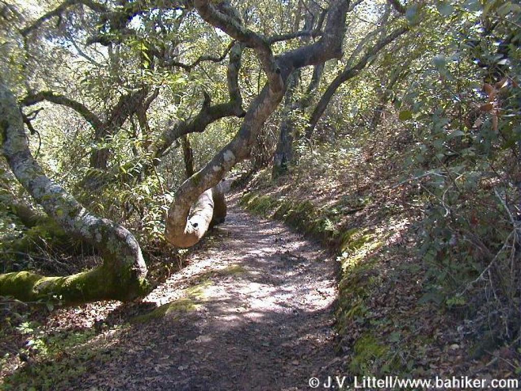
| In brief: 4.2 mile loop at a cherished preserve with an interesting mix of vegetation and pretty trails. Distance, category, and difficulty: This 4.2 mile loop hike is easy, with about 500 feet in elevation change. Edgewood's elevation ranges from about 225 feet to 820 feet. Trails are well-graded. Exposure: Mix of shade and sun. Trail traffic: Moderate. Trail surfaces: Dirt trails. Hiking time: 2 hours. Season: Nice any time, but exceptional in spring. Getting there: From Interstate 280 in San Mateo County exit Edgewood Road, then drive east on Edgewood for about 1 mile. The entrance is on the south (right) side of the road, just past Edmonds Road. GPS Coordinates* for Trailhead: Latitude Longitude (* based on Google Earth data, shown as degrees, minutes, seconds) Gas, food, and lodging: No services in the immediate area. No camping in the park. Trailhead details: There's a paved parking lot as soon as you turn off Edgewood, and a smaller paved lot inside the gate, with room for 13 cars. There is one designated handicapped parking space, and the trails are wheelchair accessible as far as the picnic area. No entrance or parking fees. An information board on the west side of the inner lot has maps. Restrooms are located near the picnic area, south of the parking lot. There are three other (minor) trailheads: at the junction of Edgewood and Cañada Roads, at the junction of Sunset and Hillcrest Ways, and on Cañada Road just south of where Cañada Road crosses under 280, at the southwestern corner of the preserve. These trailheads offer access to the Crystal Springs Trail and the western portion of Edgewood. There is no direct public transportation to the park. Rules: Sylvan Loop is designated hiking only, and all other trails are open to equestrians and hikers. No bikes. No dogs (a good alternative is Pulgas Open Space Preserve). Park hours vary seasonally. Gates open at 8 a.m. and close around dusk. The Official Story: CSMPD's Edgewood page Park office 650-368-6283 Map & book choices/More information: • Use AAA's San Francisco Bay Region map to get there. • Map from CSMPD • • Afoot and Afield: San Francisco Bay Area, by David Weintraub (order this book from Amazon.com) has a great map and descriptions of an Edgewood hike. • The Trail Center's Trail Map of the Central Peninsula is my favorite map of the park (order this map from Amazon.com) • Peninsula Trails, by Jean Rusmore, has a simple map, preserve descriptions, and suggested hikes (order this book from Amazon.com). • Tom Taber's The Santa Cruz Mountains Trail Book has a simple map and preserve description (order this book from Amazon.com). • Friends of Edgewood website. Photos: • View photos from this hike (shorter 2.91 mile Sylvan Loop) • View photos from this hike (longer 4.16 mile Sylvan and Serpentine Loop) • View a few springtime photos of the park <SCRIPT type=text/javascript> </SCRIPT> <SCRIPT src="http://pagead2.googlesyndication.com/pagead/show_ads.js" type=text/javascript> </SCRIPT> <SCRIPT src="http://pagead2.googlesyndication.com/pagead/expansion_embed.js"></SCRIPT> <SCRIPT src="http://googleads.g.doubleclick.net/pagead/test_domain.js"></SCRIPT> <SCRIPT src="http://pagead2.googlesyndication.com/pagead/render_ads.js"></SCRIPT> <SCRIPT>window.google_render_ad();</SCRIPT> <IFRAME id=google_ads_frame1 style="LEFT: 0px; POSITION: absolute; TOP: 0px" name=google_ads_frame marginWidth=0 marginHeight=0 src="http://googleads.g.doubleclick.net/pagead/ads?client=ca-pub-8722102673606492&dt=1237416012558&lmt=1225295249&output=html&slotname=1848235971&correlator=1237416012558&url=http%3A%2F%2Fwww.bahiker.com%2Fsouthbayhikes%2Fedgewood.html&ref=http%3A%2F%2Fwww.google.com%2Fsearch%3Fsourceid%3Dnavclient%26ie%3DUTF-8%26rlz%3D1T4ADBF_enUS287US288%26q%3Dedgewood%2Bpark&frm=0&ga_vid=1312686691.1237416013&ga_sid=1237416013&ga_hid=976609978&flash=10.0.22.87&u_h=900&u_w=1440&u_ah=872&u_aw=1440&u_cd=32&u_tz=-420&u_his=11&u_java=true&dtd=109&w=120&h=240&xpc=vbxjFIwT8R&p=http%3A//www.bahiker.com" frameBorder=0 width=120 scrolling=no height=240 allowTransparency></IFRAME> |
Edgewood is a small block of land in Redwood City, Total distance: 4.16 miles | ||


- ?
-
?
저도 가까운 곳에 이리 좋은 조깅 코스가 있는 줄 모르고 맨날 쿠퍼티노 란쵸 산안토니오까지 갔었는데, 얼마전 백인 친구들이랑 조깅하면서 알게됬어요. 이 동네 사는 사람들이라 그런지 잘알고 있더라구요.
알았으면 진즉 자주 갔을 텐데...
저는 산 정상에서 ( 정상이라기에 는 너무 가볍지만) 바라본 포스터 시티와 산마테오 다리 풍경이 너무 예뻤고, 반대쪽으로 보는 280 쪽 산경치도 좋았어요.
그래도 트레일을 전부 왔다갔다 하면 꽤 운동이 되었어요
-
Read More
해프 돔 (Half Dome)
언제 갈 수 있을지는 모르지만 정보를 한 번 추려 봅니다. 이전 글 링크: http://www.bayalpineclub.net/freeboard/131077 베이산악회 게시판을 검색해도 많은 자... -
Read More
멋진 사진들 (5)
사진을 누르면 크게 보실 수 있습니다. 1. 고층건물 2. 러시아의 세계 최대 해저 동굴 3. 몽고 독수리 사냥 4. 비행궤도 5. 아빠와 아들 6. 에쿠아돌 7. 춤추는 ... -
Read MoreNo Image
산악회 홈페이지 로그인 문제...
Situation Summary: 어제 (3/23) 밤에 베이산악회 홈페이지 접속이 안되는 상황이 발생했습니다. (발견 시간: 새벽 1시 경) 몇 년 전의 Phishing 사건의 악몽이 ... -
Read MoreNo Image
MedImmune Research Summer Intern Program – 2009(2 h...
For high school and college kids: Research Summer Intern Program – 2009 Research will be hosting 6 student interns this summer (2 high school – rising ... -
Read More

케블라
지난 번에 나그네님과 장갑에 관한 이야기를 나누었습니다. 해프돔의 쇠줄을 보니까 장갑도 이런 필요에 맞는 것이 하나 필요하진 않을까 하는 생각이 스칩니다. ... -
Read MoreNo Image
곧 지구상에서 영원히 사라져 버릴 빙하 : Lyell & Ma...
라열 (Lyell) 빙하와 맥크러 (Maclure) 빙하는 이번에 백팩킹 가는 좐 뮤얼 트레일 (John Muir Trail) 의 튜오루메 메도 (Tuolumne) 에서 시작해서 라열 캐년( Ly... -
Read MoreNo Image
독도 일본령 청원서 -- 반대운동
얼마전에 무지개님이 올리신 정보입니다. 저도 조금전에 끝냈는데, 쪼금 (3과정) 복잡하네요. 전쟁에대해 반성하지않은 일본의 뻔뻔함, 우리 조국의 영토을 운운... -
Read More
인터넷에서 악보 찾기
http://images.google.com 에서 제목 + 악보 라고 넣으면 찾기가 쉽습니다.예) 갑돌이와 갑순이 악보 1. 위 링크에서 찾을 제목과 악보라고 적어 넣습니다. 2. 나... -
Read More
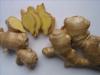
어지럼증에는 생강 (ginger)
혹시 배, 차, 놀이기구 등을 타고 멀미를 하시는 분을 아시면 흔히 사 드시는 Dramamine 같은 약도 좋지만 생강을 한 번 시도해 볼만 합니다. ( Dramamine 같은 ... -
Read More
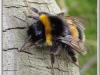
벌에 쏘였을 때 처치법
벌에 쏘였을 때 - 한글 자료 http://www.koreapediatrics.com/ency/chp01/chp01_0093.htm http://www.koreahealthlog.com/2397 예방 긴팔옷과, 긴바지, 장갑, 모... -
Read More
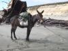
노새
어떤 분이 블로그에 올리신 시에라 네바다 산맥에서 짐과 사람을 날라다 주는 말 (어쩌면 아마도 노새) 들의 이야기입니다. 사진이 있어서 이해가 쉽군요. 블로그... -
Read MoreNo Image
수요 벙개 합시다.
내일 수요일에는 플레젠튼에서 벙개합니다. Main Street에 있는 Locanda Amalfi에서 피자에 맥주 한잔 합니다. https://g.page/locanda-amalfi?share 12시 쯤 오... -
Read More
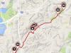
11/5 (일요Riding) Iron horse trail 왕복 54mi
1. 1차 출발 7:30 AM Marsh rd trail head ,Concord 2. 2차 출발 8:30 AM Rudgear staging area ( Alamo//Danvile 중간) 3. 준비물 : 자전차 물 행동식 or 돈 or ... - Read More
-
Read MoreNo Image
2/04/18(일요산행) Point Reyes NS - 산행 사진 공유
오늘 덕분에 즐겁고 행복한 산행이었습니다. 제가 찍은 사진들을 다운 받으실 분들은 이메일 주소를 문자나 메일로 보내 주시면 제 Google Drive 에서 다운 받을 ...
정말 근사한 곳이더군요. 오후 늦은 시간이어서인지 사람들은 꽤 있는 편이었지만, 짜투리 시간 활용으로 아주 좋은 곳입니다. 가벼운 산책이나 조깅으로... 280이 가까이 있어 차소리는 좀 많이 나는 편이더군요.
좋은 정보 감사합니다.