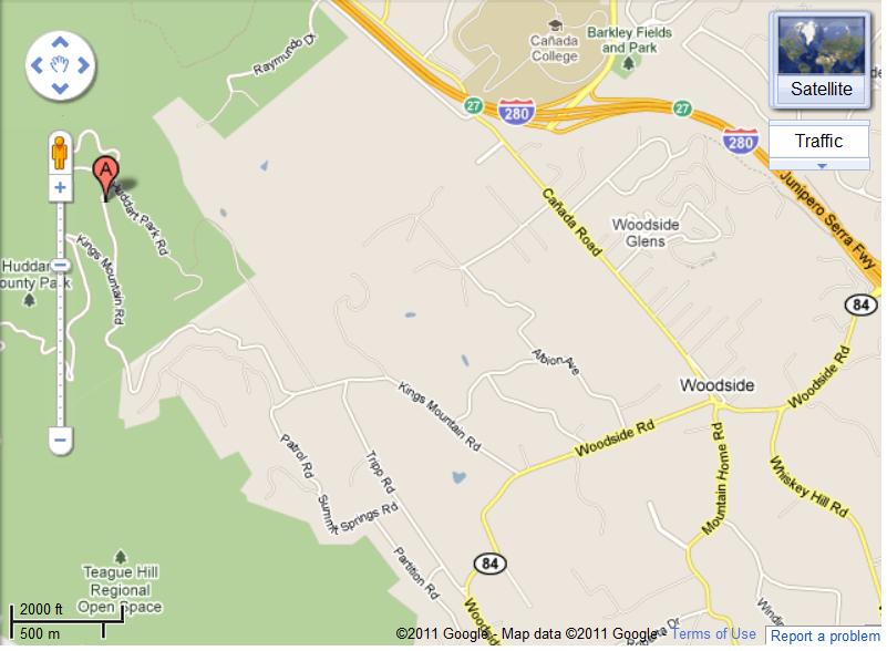
이번 일요산행은 Huddart/ Phleger입니다. (산악회에서는 처음 시도해보는 긴 Huddart Trail 입니다)
파킹랏이 여러군데 있습니다. 입장료 지불후 바로 왼편에 있는 파킹랏에서 만나신후 Trailhead로 이동하시면 좋겠습니다.
형편상 일요산행만을 해야하는 횐님들과 또다른 횐님들을 위한 일요산행도
계속 이어지길 바랍니다.
좋은 산행되시기 바랍니다.
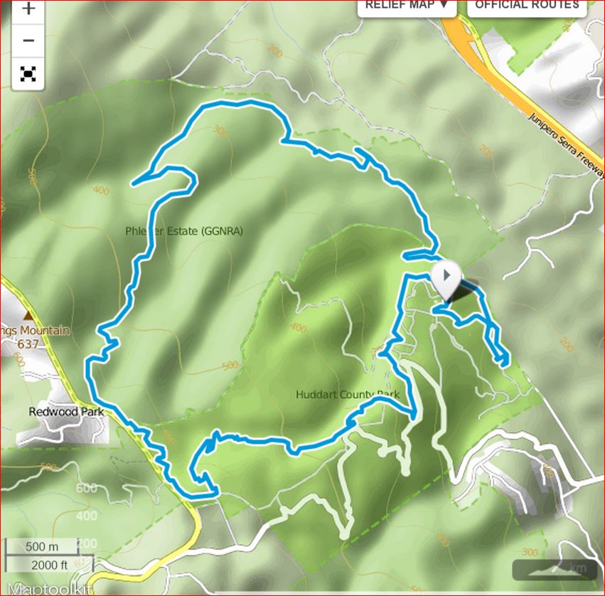
Route Details:
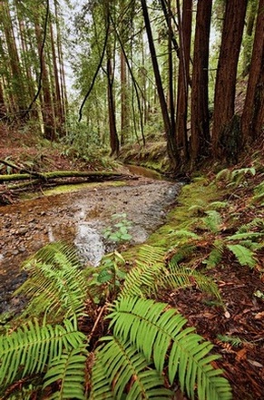 Union Creek flowing through Phleger Estate
- 0.0 mi: From the south end of the parking area, head downhill on the Bay Tree Trail.
- 0.7 mi: When the trail ends, take a hard left onto Richards Road Trail. You will follow Richards Road as it gradually climbs for the next 0.9 miles.
- 1.6 mi: Veer right onto Miramontes Trail and enter Phleger Estate. You will follow Union Creek on a beautiful singletrack trail for the next mile.
- 3.0 mi: Turn right at the intersection with Mt. Redondo Trail, head downhill briefly, then turn left onto Raymundo Trail. Get ready for some steep climbing!!
- 4.6 mi: Just after the Raymundo trail flattens out, turn right onto Lonely Trail for more climbing!! (You didn't think you were done, did you??)
- 5.2 mi: Pass the first bench.
- 5.5 mi: Pass the second bench.
- 6.1 mi: The trail flattens out and reaches an intersection. Turn left to continue on the Lonely Trail. (Note: If you want to get water at the Kings Mountain Fire Station, turn right at this intersection. In 0.1 mile you will see the fire station, and there is a water hose out back. After filling your bottle, retrace your steps on the Lonely Trail).
- 6.4 mi: The Lonely Trail ends at Richards Road Trail. Turn left (downhill), then immediately turn right onto the Skyline Trail (singletrack).
- 6.9 mi: The Skyline Trail singletrack ends on a fire road. Turn left on the fire road (away from Skyline Blvd).
- 7.1 mi: Turn left onto Chinquapin Trail, and start an awesome 3-mile descent!
- 8.9 mi: CONFUSING INTERSECTION! The Chinquapin Trail runs along the left side of Archery Fire Road. Stay left on the singletrack and then around a left-hand switchback. The Chinquapin Trail will then end on the Dean Trail (fire road). Cross the fire road and take a sharp right on the Dean Trail singletrack doing downhill. If you find yourself on a fire road, you went the wrong way! You will now follow the Dean Trail all of the way to where it ends on the Crystal Springs Trail.
- 9.1 mi: Cross the Archery Fire Road - continue on Dean Trail.
- 9.5 mi: Cross the Archery Fire Road again - continue on Dean Trail.
- 9.7 mi: At the paved road - turn left to stay on the Dean Trail.
- 10.0 mi: Continue past the paved road and stay on the Dean Trail.
- 10.2 mi: Dean Trail ends on the Crystal Springs Trail, turn right toward the parking area.
- 10.4 mi: Back at the parking lot and your car!


